Environment and Agriculture

Scientists capture Haiti disaster with high-tech imaging system

JANUARY 29, 2010--In the aftermath of the Jan. 12 earthquake that struck Haiti's capital, Port-au-Prince, scientists from Rochester Institute of Technology are sweeping the leveled city with high-tech imaging integrated into a small aircraft.
Jan. 29, 2010
3 min read
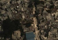
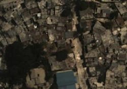
JANUARY 29, 2010--In the aftermath of the Jan. 12 earthquake that struck Haiti's capital, Port-au-Prince, scientists from Rochester Institute of Technology (RIT; Rochester, NY, USA) are sweeping the leveled city with high-tech imaging integrated into a small aircraft. Funded by the World Bank, and in collaboration with ImageCat, the five-day flight is responsible for mapping the disaster zone to aid in crisis management and eventual reconstruction of the city. Beginning Jan. 21, a twin engine Piper Navajo, operated by Ohio-based aerial mapping company Kucera International, flew from Aguadilla, Puerto Rico, and refueled daily in the Dominican Republic. The plane was flown at 3,000 feet over Port-au-Prince and other areas badly hit by the earthquake.

(Courtesy of RIT, World Bank, ImageCat)RIT has coupled an imaging system it created for the U.S. Forest Service to detect wildfires using high-resolution color imagery and thermal infrared with Kucera's LIDAR topographical sensing system. LIDAR makes precise measurements with laser pulses and complements the other modalities in 3-D layered image maps. RIT scientist Jason Faulring operated the camera system to survey damage, detect fires, chemical spills, and surface contamination on lakes or ponds. George Tatalovich and James Bowers were the pilots for Kucera International; Bowers operated the LIDAR sensor. Thermal imaging provides relief and recovery agencies with critical insight not available from standard color photography. "You can tell how much liquid is in a storage tank with a thermal camera," says Don McKeown, scientist in RIT's Chester F. Carlson Center for Imaging Science and project manager. "You can make inferences of tanks that are full, tanks that are empty, and tanks that are leaking."

The LIDAR capability detects and measures collapsed buildings and standing structures damaged by the earthquake. At the request of the U.S. Geological Survey, Faulring is using LIDAR to map the fault line to estimate how much the earth moved. This information is critical to refinement of earthquake-risk prediction models.

"This has been a huge team effort between RIT and a host of collaborators," says Jan van Aardt, associate professor of imaging science and director of the Laboratory for Imaging Algorithms and Systems at RIT. The laboratory within RIT's Carlson Center for Imaging Science developed the sensor system and is working closely with RIT's Digital Imaging and Remote Sensing group to explore applications. "If it had not been for this close-knit collaboration between the two teams, we never would have pulled this off," van Aardt adds. "Next steps will include collaborative product development to aid the relief effort."

For more information, visit www.sciencedaily.com.

-- Posted by Carrie Meadows, Vision Systems Design
Find more information on Environment/Agriculture applications*Adapted from materials provided by Rochester Institute of Technology

Sign up for Vision Systems Design Newsletters

Voice Your Opinion!

To join the conversation, and become an exclusive member of Vision Systems Design, create an account today!