Lidar unveils possible Honduran archaeological ruins
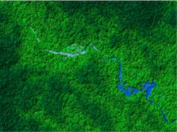
A team from the University of Houston (UH; Houston, TX, USA) and the National Science Foundation (NSF) National Center for Airborne Laser Mapping (NCALM; Houston, TX, USA) has mapped a remote region of Honduras that may contain the legendary lost city of Ciudad Blanca.
The results mark the successful completion of the first light detection and ranging (lidar) survey of part of that country's Mosquitia region, one of the world's least-explored virgin rainforests.
An initial analysis of the lidar survey has identified ruins that could be those of Ciudad Blanca or other long-hidden sites. The information provides archaeologists with the precise locations of features within fractions of meters for further archaeological study.
UH professors Ramesh L. Shrestha and William E. Carter have been working with refining and applying airborne lidar to unveil the surface of the earth, primarily for earth scientists researching surface processes, for more than a decade.
In 2009, the UH researchers and a field team composed of Michael Sartori, Juan Fernandez-Diaz and Abhinav Singhania successfully mapped the Caracol archaeological site in Belize using airborne lidar.
The images collected were reduced and filtered to remove the vegetation and provide images of the terrain’s surface below the rainforest. Those images were then searched by eye to study geomorphological features as well as potential archaeological ruins.
Even though the site was covered with dense rainforest, the lidar data captured building ruins and agricultural terraces not discovered by archaeologists working on the ground for over 25 years.
-- by Dave Wilson, Senior Editor, Vision Systems Design
