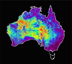
Mineral maps created from satellite imaging data
Australian researchers at CSIRO (Clayton, Australia) have produced a new suite of mineral maps of Australia that will help mining companies to explore areas of interest.
The world-first maps were generated from a ten-year archive of raw data from the Advanced Spaceborne Thermal Emission and Reflection (ASTER) imaging instrument onboard Terra, the flagship satellite of NASA's Earth Observing System (EOS) which was launched in December 1999.
The CSIRO scientists developed software that transformed the data into a continent-wide suite of mineral maps that show information about rock and soil mineral components and provide a Google-like zoom to view images from thousands of kilometers wide to just a few kilometers.
The ASTER maps are the result of a collaborative effort between scientists from Japan, the US and Australia. Data access and software development was co-ordinated by CSIRO through the Western Australian Centre of Excellence for 3-D Mineral Mapping.
The Australian ASTER geoscience maps can be obtained from the AuScope Discovery Portal here.
-- Dave Wilson, Senior Editor, Vision Systems Design
