Machine Vision/Imaging Software

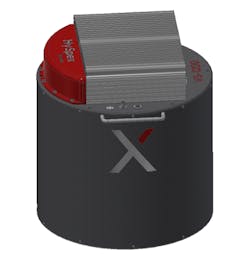
HySpex VS-1200

Feb. 16, 2022

Novel, high-resolution instrument designed for airborne applications at altitudes >400m. 40° FOV ideal for mapping large areas with high accuracy and resolution. Highest level scientific-grade data commercially available, having FWHM <1.2 pixels spatially and <1.5 pixels spectrally. Coregistration errors <10% of a pixel. Delivered with integrated, high-performance IMU/GPS and DAU with removable storage. Existing navigation systems can be integrated/utilized. Passive damping solution included in default package. Mounting plates for active damping solutions, such as GSM4000 or PAV80 available.
Learn More

Request Information

By clicking above, I acknowledge and agree to Endeavor Business Media’s Terms of Service and to Endeavor Business Media's use of my contact information to communicate with me about offerings by Endeavor, its brands, affiliates and/or third-party partners, consistent with Endeavor's Privacy Policy. In addition, I understand that my personal information will be shared with any sponsor(s) of the resource, so they can contact me directly about their products or services. Please refer to the privacy policies of such sponsor(s) for more details on how your information will be used by them. You may unsubscribe at any time.